Our take: Best for developers building geospatial AI agents with cited government data; free tier with 5k credits/month, paid from $19/mo.
Main limitation: Parcel lookups cost 300 credits each; US coverage only
By the AI Tool Atlas editors.
Based on the vendor's official documentation; we have not tested this product hands-on. What “documented overview” means
Mireye pricing and usage limits
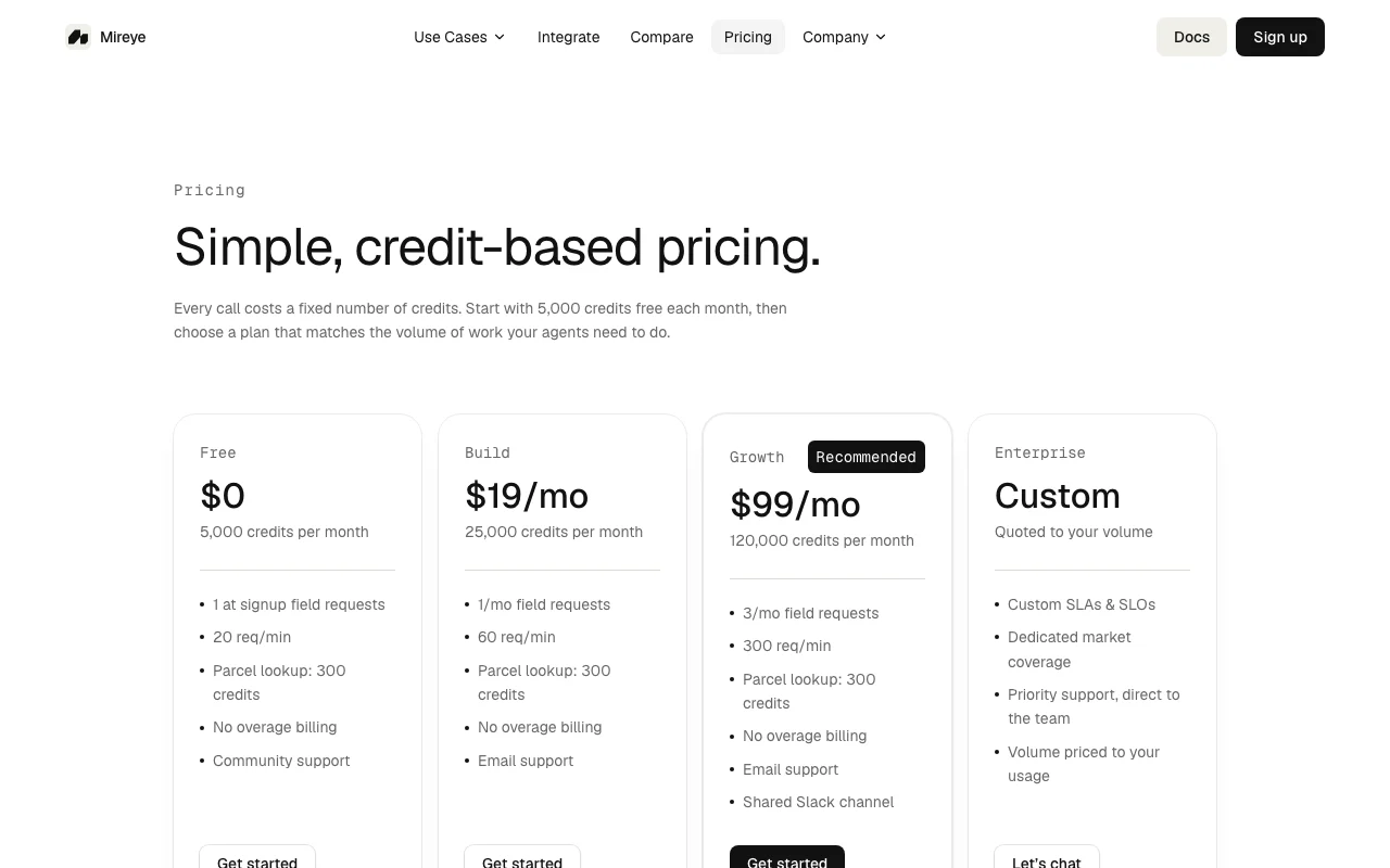
Prices checked Oct 1, 2026 on the official US pricing page. Official pricing ↗ Prices and limits change often.
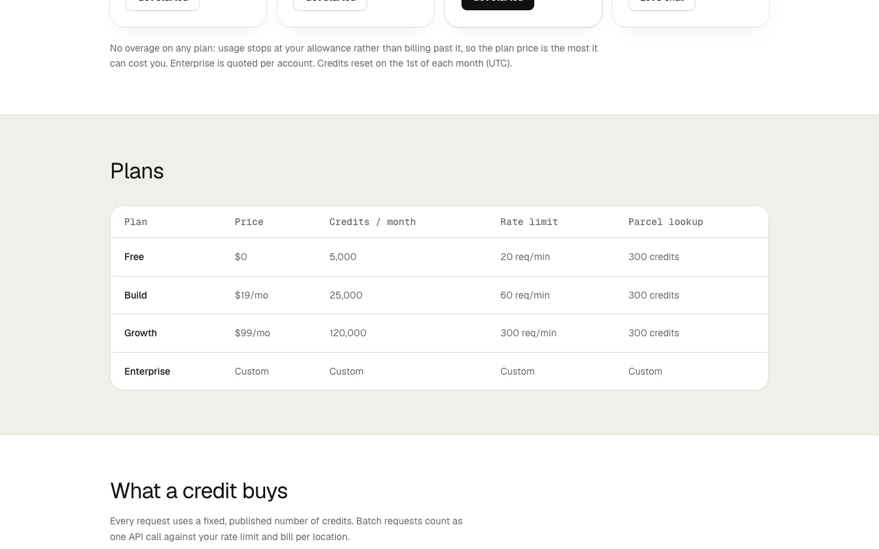
The official Mireye pricing page as we saw it. mireye.com, captured Oct 1, 2026
Free access and trial conditions
5,000 credits per month; no credit card required
Free tier serves as perpetual trial
Paid plans: what changes as you upgrade
Free self-serve
Free
Month
For: Testing geospatial APIs; small agents
Limits
5,000 credits/month
20 req/min rate limit
1 more
1 field request at signup
Includes
Geocode
Field requests
2 more
Ask endpoint
Community support
API included
Build self-serve
$19/mo
Month
For: Developers building small-scale geospatial agents
Limits
25,000 credits/month
60 req/min rate limit
1 more
1 field request per month
Includes
All Free features
Higher rate limits
1 more
Email support
API included
Growth self-serve
$99/mo
Month
For: Growing teams with active geospatial agent workloads (recommended)
Limits
120,000 credits/month
300 req/min rate limit
1 more
3 field requests per month
Includes
All Build features
Shared Slack channel
1 more
Priority support
API included
Enterprise sales
Custom pricing
Month
Custom SLAs
For: Enterprises with sustained high volume
Limits
Custom volume
Custom rate limits
1 more
Unlimited field requests
Includes
All Growth features
Custom SLAs
1 more
Dedicated support
API included
Usage caps, credits and extra costs
Parcel lookup (300 credits) is main cost driver
USD pricing
What is Mireye, and how does it work?
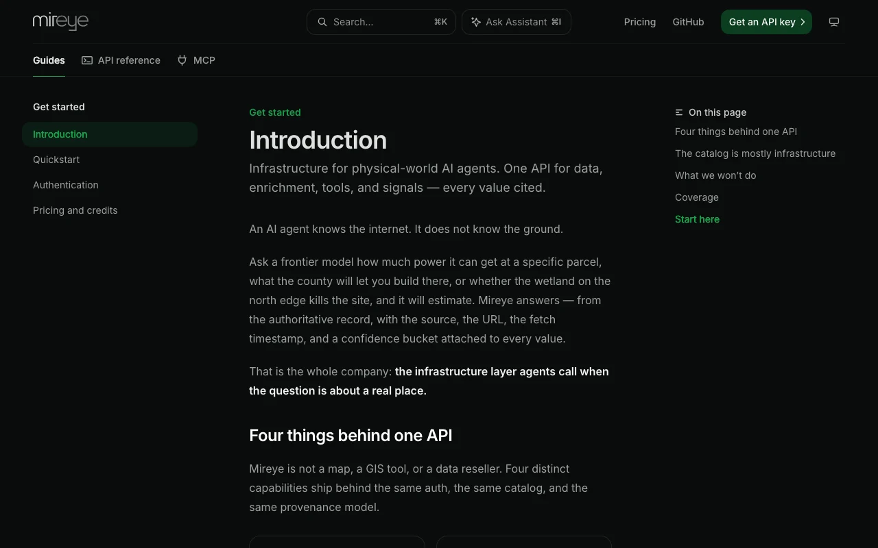
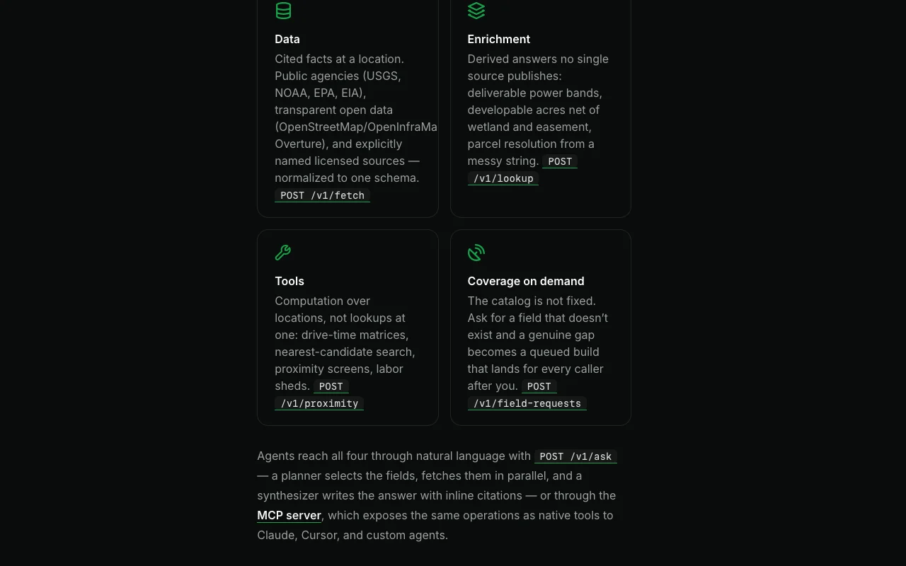
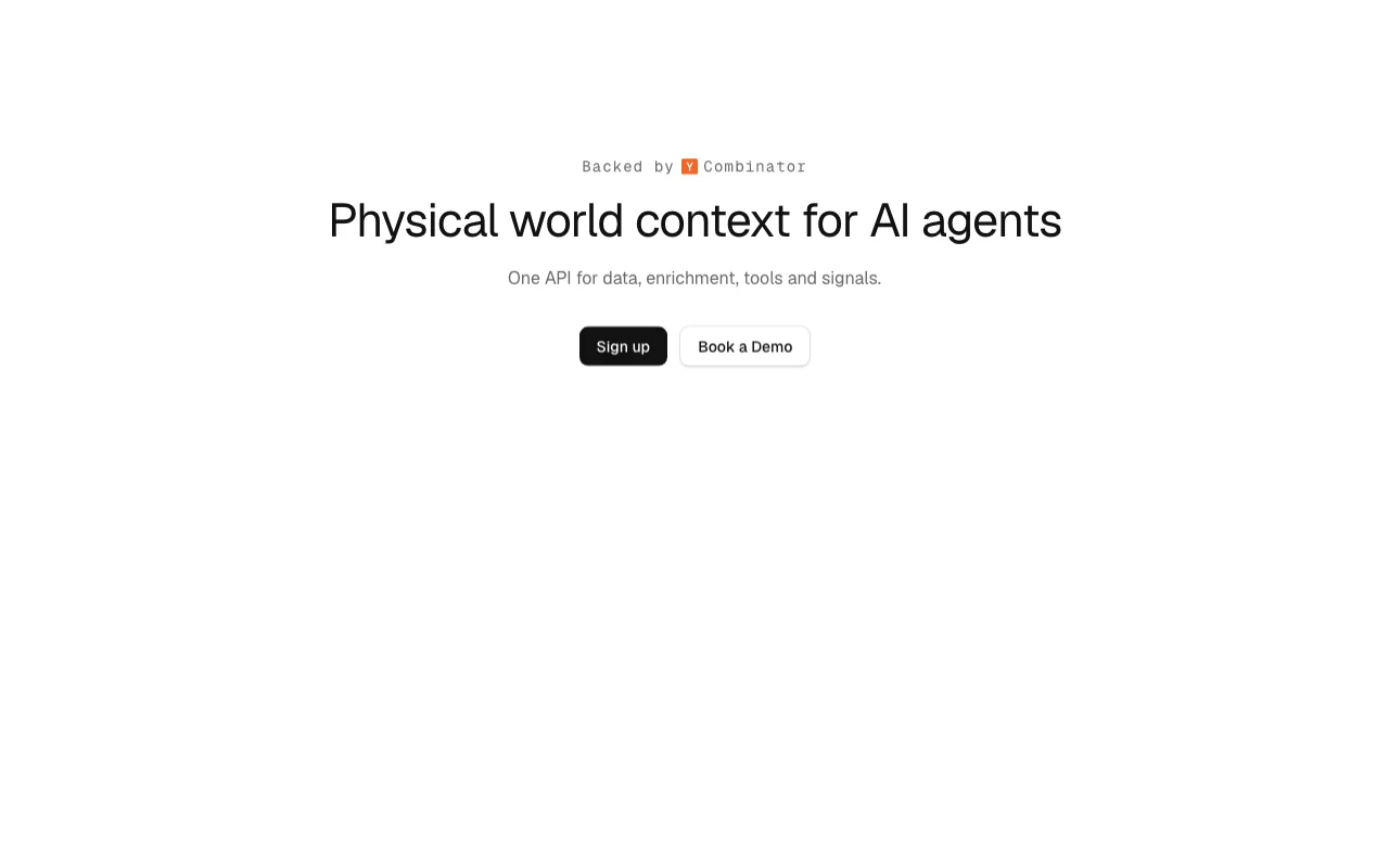
Mireye is a Y Combinator-backed API that gives AI agents cited facts about physical locations from USGS, FEMA, NOAA, Census, EPA, parcel records and satellite imagery. Each value comes with a source, fetch timestamp and confidence. Endpoints include ask, geocode, lookup, fetch, proximity and field requests with MCP tool support.
Mireye's official site: how the product presents itself. mireye.com, captured Oct 1, 2026
What you provide and what you get back
What you give Mireye and what comes back, from its documentation
You provide
Addresses or GPS coordinates
Natural-language questions about locations
Batch API requests for multiple locations
Custom field requests for unlisted data
You get back
Geocoded coordinates with accuracy ratings
Cited facts from government sources
Drive-time matrices and proximity calculations
Parcel boundaries and ownership records
Where you can use it
Platforms
API, MCP
Account
Required
Best use cases for Mireye
Scenarios are worked out by our editors from the documentation; the actual result depends on your input and plan.
Enriching addresses with geospatial facts for real estate agents
Who
Real estate platforms, insurance underwriters, location analysts
You provide
Address or coordinates; optional field list
Expected result
Elevation, flood risk, census demographics, parcel ownership, proximity to amenities
Plan needed
Free for testing; Build ($19/mo) for ongoing enrichment
Feature overview on the official site. mireye.com, captured Oct 1, 2026
Geocode endpoint (1 credit per call)
Convert address to GPS coordinates with accuracy rating; coarse matches are refused Standardize user-entered addresses; enable proximity and field requests
Access: All plansLimit: No fuzzy matching; returns nothing for ambiguous or invalid addressessource (opens in a new tab)
Field requests (1 credit each, 327+ fields available)
Fetch any of 327 cited facts about a location (elevation, soil type, census data, flood risk, etc.) Enrich location data without calling multiple external APIs
Access: All plans; monthly allowance per tierLimit: Some fields may have data gaps in rural areas; custom field requests take timesource (opens in a new tab)
Ask endpoint (10 credits per call)
Answer natural-language questions about any US location with citations AI agents can answer user questions without separate NLP pipelines
Access: All plansLimit: US-only; quality depends on question phrasing and available datasource (opens in a new tab)
Lookup endpoint (300 credits per call)
Fetch canonical parcel info, boundary geometry, owner of record, county and census codes Verify property ownership and boundaries for real estate and title workflows
Access: All plans; charged only on successful matchesLimit: Backed by county parcel records with per-record licensing; Free can afford ~16 lookups/monthsource (opens in a new tab)
Pros, cons and deal-breakers
Where Mireye is strong
All values are cited with source, fetch timestamp and confidence Agents can explain their answers with authoritative government sourcesdocumentedsource (opens in a new tab)
No overage billing on any plan; usage capped at monthly allowance Predictable costs; no surprise charges during traffic spikesdocumentedsource (opens in a new tab)
Fixed credit prices for all requests; pricing is transparent and simple Easy cost estimation for integration; no variable per-call pricingdocumentedsource (opens in a new tab)
Y Combinator-backed with authoritative government data sources Data quality and platform stability professionally maintaineddocumentedsource (opens in a new tab)
Limitations to check before paying
Parcel lookups cost 300 credits each (expensive per request) High cost for title or ownership verification workflowsdocumentedsource (opens in a new tab)
Rate limits per plan (20-300 req/min); may be restrictive for high-volume agents Batch requests required for large-scale enrichment; custom SLAs for sustained volumedocumentedsource (opens in a new tab)
Ask endpoint covers US locations only International location queries not supporteddocumentedsource (opens in a new tab)
Field data varies by location; some rural areas have limited coverage Agents may receive incomplete answers for underserved regionsdocumentedsource (opens in a new tab)
How to use Mireye for geocode addresses and fetch geospatial facts
Mireye documentation: where the steps below come from. docs.mireye.ai, captured Oct 1, 2026
Set up Mireye
Sign up for free account at mireye.com
Create an API key in the dashboard
Start using Geocode endpoint with curl or Python
Example: geocode addresses and fetch geospatial facts
Geocode: curl with address parameter
Fetch fields: Pass coordinates and field names
Ask endpoint: POST with location and natural-language query
Lookup parcel: Request parcel info for property verification
Review and export the result
Verify API key is active and has remaining credits
Check rate limit status in response headers
Confirm field requests return cited sources
Mireye API
Mireye documentation (continued). docs.mireye.ai, captured Oct 1, 2026
Every plan pauses until credits reset on the 1st (UTC). Calls are refused rather than billed, so you can't run up charges. source (opens in a new tab)
Do credits roll over to next month?
No. The allowance resets on the 1st (UTC). If you subscribe mid-month, you get full allowance for remainder. source (opens in a new tab)
Why does Lookup cost so much (300 credits)?
Lookup is backed by authoritative county parcel records with per-record licensing. Charged only on verified matches. source (opens in a new tab)
What is a field request?
A field your account hasn't seen in our catalog. Requests are matched against existing fields first (free), charged only for truly new data. source (opens in a new tab)
Not verified: Data freshness and update frequency; Field coverage breakdown by region; API response latency targets; Batch request size limits.
How we documented and maintain this page
Every fact about Mireye above comes from the 2 official pages listed here, last compared on Oct 1, 2026; we have not run Mireye ourselves, so it has no editorial score. How we check and re-check pages.
Article updated Oct 10, 2026; prices checked Oct 1, 2026. Outbound links to vendors are plain links; we do not earn commissions. How we review · Report an error


 (open full size in a new tab)
 (open full size in a new tab)
 (open full size in a new tab)
 (open full size in a new tab)
 (open full size in a new tab)
 (open full size in a new tab)